November Full Moon Hike – Lodi Valley Chapter

The Hike:

Greetings Walkers and Hikers!

Grab your jacket and get out of the house! Another Full Moon hike is coming up! An opportunity to work off those extra pieces of pumpkin pie…you know who you are.

Wear appropriate clothing and shoes for the weather.  This walk will be more than a mile one-way, low key, and family friendly. Well behaved, leashed dogs are welcome.   

This month’s full moon is known​ as the Full Beaver Moon, the time to set beaver traps before the swamps froze to ensure a supply of warm winter furs. Another interpretation suggests that the name Full Beaver Moon comes from the fact that the beavers are now actively preparing for winter. It is sometimes also referred to as the Frosty Moon or the Snow Moon.

Event details:

Monday, November 27th at 7:30 pm @ Hwy 113 South trailhead.

Location details:

We will meet at the Trailhead; Watch for the yellow Ice Age Trail Event signs.

Questions? Contact Bill at billpatti@charter.net or 608-843-3926.

Next Full Moon Hikes:

December 27th…hiking with Santa and assorted elves (cookies may be involved)


Photo by: Cameron Gillie

November Tyke Hike

The Hike:

Join the Ice Age Trail Alliance Lodi Valley Chapter for our next Tyke Hike! These short walks are designed for young children accompanied by an adult, with a focus on noticing things in nature. During this hike we’ll look for seasonal changes as winter approaches.
We hope to see you at the Tyke Hike!

Event details:

 Saturday, November 18th at 10:00 am

Location details:

We will meet at the Ferry Landing Parking Lot; Watch for the yellow Tyke Hike signs.

Questions? For more information call Patti at 608-843-3924 or billpatti@charter.net

Waukesha/Milwaukee Chapter: Lapham Peak Segment Hike

Photo by Tonia Froling

The Hike:

Please join us for a hike on the Lapham Peak Segment of the Ice Age National Scenic Trail. Winding through woods and prairie, it includes outstanding views from the observation tower.

Details:

This leisurely-paced hike is approximately 4 miles long. Hiking poles are helpful. Bring water and dress for the weather. This hike will only be canceled if weather or conditions are unsafe. All ages and abilities are welcome. Ages 17 and under must be accompanied by a parent or guardian.

Location:

Meet at the Cushing Memorial Park parking lot. We will leave some vehicles there and carpool to the Tower Parking Lot where we will begin our hike.

Contact Information:

Email comments or questions to Mark, your hike leader.


October Tyke Hike – Halloween Theme!

The Hike:

Join the Ice Age Trail Alliance Lodi Valley Chapter for our next Tyke Hike! These short walks are designed for young children accompanied by an adult, with a focus on noticing things in nature. This hike will be Halloween themed so wear your costumes as we trick or treat along the trail.
We hope to see you at the Tyke Hike!

Event details:

 Saturday, October 28th at 10:00 am

Location details:

We will meet at the Lodi High School Trailhead; Watch for the yellow Tyke Hike signs.

Questions? For more information call Patti at 608-843-3924 or billpatti@charter.net


Photo by: Christina Callies

October Full Moon Hike – Lodi Valley Chapter

The Hike:

Greetings Walkers and Hikers!  Another Full Moon hike is coming up!

Celebrate the Halloween season with a full moon hike through the Lodi Marsh Segment. Bring a flashlight or headlamp and wear sturdy shoes. Expect a 2 to 3-mile hike. The parking lot is small so carpool if possible.

Wear appropriate clothing and shoes for the weather.  This walk will be more than a mile one-way, low key, and family friendly. Well behaved, leashed dogs are welcome.            

Event details:

Sunday, October 29th at 7:30 pm @ Twin Pines trailhead.

Location details:

We will meet at the Trailhead; Watch for the yellow Ice Age Trail Event signs.

Questions? Contact Bill at billpatti@charter.net or 608-843-3926.

Next Full Moon Hikes:

November 27th

December 27th…hiking with Santa and assorted elves (cookies may be involved)


Photo by: Cameron Gillie

September Full Moon Hike – Lodi Valley Chapter

The Hike:

Greetings Walkers and Hikers!  Another Full Moon hike is coming up!

This month we will venture out at the Robertson Trailhead.

Wear appropriate clothing and shoes for the weather.  This walk will be more than a mile one-way, low key, and family friendly. Well behaved, leashed dogs are welcome.            

Event details:

Thursday, September 28th at 7:30 pm @ Robertson trailhead.

Location details:

We will meet at the Trailhead; Watch for the yellow Ice Age Trail Event signs.

Questions? Contact Bill at billpatti@charter.net or 608-843-3926.

Next Full Moon Hikes:

October 29th

November 27th

December 27th…hiking with Santa and assorted elves (cookies may be involved)


Gibraltar Rock Segment Hike – Mini Mammoth Hike Challenge

The Hike:

This guided hike through the iconic Gibraltar Rock Segment is through some of the most beautiful sections of the IAT. Expect a challenging hike with rewarding views. Options are to complete the whole segment round trip (10 miles) or stop half-way for a 5-mile hike. Wear sturdy shoes and bring water and a snack. You’ll be in for a treat! This hike is led by the Lodi Valley Chapter

Event details:

Sunday, October 22nd at 9:00am @ South Ferry Landing

Location details:

We will meet at the South Ferry Landing; Watch for the yellow Ice Age Trail Event signs.

Lodi Segment Hike – Mini Mammoth Hike Challenge

The Hike:

Experience Trail Community Lodi in this guided hike on the Lodi Segment. This 4-mile round trip hike mixes a pavement walk through Lodi’s quaint downtown and historical district as well as a footpath through the woods. Meet at the Lodi Chamber of Commerce Visitor Center where you’ll see an interactive IAT display. Parking is on Spring Street and Main Street. Come early for a coffee in town or stay for lunch afterwards. This hike is led by the Lodi Valley Chapter.

Event details:

Saturday, October 21st at 9:00am @ Lodi Chamber of Commerce Visitor Center

Location details:

We will meet at the Lodi Chamber; Watch for the yellow Ice Age Trail Event signs.


Photo by: Ashley Fryk

Steenbock Preserve Hike – Mini Mammoth Hike Challenge

The Hike:

Enjoy this guided hike through Gibraltar Rock Segment’s Steenbock Preserve led by IATA’s Land Restoration Specialist, Steve Pence. The preserve is a rare mesic prairie with views of Lake Wisconsin and the Baraboo Bluffs. Steve will identify plants and explain how this property is actively managed for diversity and health.  Expect a 3 to 4-mile round-trip hike and up/down a 200-foot bluff.  For more miles, continue hiking the segment on your own.

Event details:

Sunday, October 8th at 9:00am @ South Ferry Landing (Lodi side of Merrimac Ferry)

Location details:

We will meet at the Ferry Landing; Watch for the yellow Ice Age Trail Event signs.


Photo by: Serena Stipek

September Tyke Hike

The Hike:

Join the Ice Age Trail Alliance Lodi Valley Chapter for our next Tyke Hike! These short walks are designed for young children accompanied by an adult, with a focus on noticing things in nature. During this hike on the Gibraltar Segment we’ll look for early signs of fall.
We hope to see you at the Tyke Hike!

Event details:

 Saturday, September 16th at 10:00 am @ Gibraltar Rock

Location details:

We will meet at the Gibraltar Rock Trailhead; Watch for the yellow Tyke Hike signs.

Questions? For more information call Patti at 608-843-3924 or billpatti@charter.net

Member Event: Behind-the-Scenes Blue Hills Hike – Rusk County

Seek Natural Thrills Not Supernatural Chills on Friday the 13th!

Deep within Rusk County forest land in northwest Wisconsin are some of the most spectacular, geologically unique sites in all of Wisconsin: Devil’s Elbow, Gundy’s Canyon, Devil’s Kettle, and more. These geological gems, hidden in a rugged and remote area, are known primarily to locals and geologists.

Be among the few to visit these sites most have never seen or heard of during this special member event! You’ll go behind-the-scenes on a tour of an area that may soon host rerouted miles of Ice Age National Scenic Trail.

Enjoy a sneak peek of this geological grandeur!

The Dreamer Route features spectacular, geologically unique sites. Photo by Dave Caliebe.

See these geological gems for yourself! Photo by Dave Caliebe.

This five-mile guided hike along a possible future route of the Blue Hills Segment presents rough, challenging terrain. Prepare for uneven ground, bush whacking, stumps, and rocks. The hike will be held rain, snow, or shine.

Enjoy a post-hike cookout at the Murphy Flowage picnic area and meet local chapter volunteers.

Hike Guides:

  • Dave Caliebe, Trail Program Manager for the Ice Age Trail Alliance
  • Fred Nash, Rusk County resident and Blue Hills Chapter Coordinator

Member Event Details:

Friday, October 13

9:00 a.m. – 3:00 p.m.

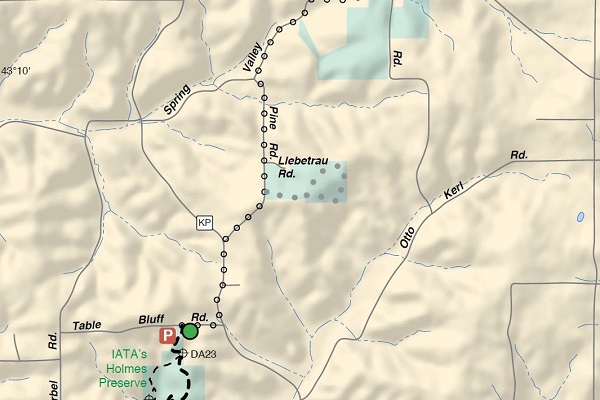
Blue Hills region, Rusk County (specific location details will be shared in the registration confirmation email).

Space limited to 25 hikers. $25.00/hiker (includes guided hike and cookout). Register today!

Be among the few to visit these incredible sites! Photo by Dave Caliebe.

These geologic features are mainly known only to locals and geologists. Photo by Dave Caliebe.


Good news: This member hike is an official Mammoth Hike Challenge event and qualifies for 10 bonus miles!

Remember! Sharing photos from this unique hiking adventure on social media (#MammothHikeChallenge, @iceagetrail) will help you rack up 5 bonus miles.

Not an Alliance member? Become a member (and qualify for 10 bonus miles!).

Experience geological wonders, hike potential future Ice Age Trail, and count this event as bonus miles for the Mammoth Hike Challenge! Photo by Dave Caliebe.

Make a Weekend of it – Accumulate Mammoth Hike Challenge bonus miles!

Stick around and explore neighboring Chippewa County. Hike the Chippewa River Segment and Meet Monty on October 14. Attending this official Mammoth Hike Challenge event will garner you 10 bonus miles!

And visit nearby Trail Communities, St. Croix Falls, Cornell, and Rib Lake. (If one of these is your fourth Trail Community, it qualifies for 10 bonus miles.)

The region’s ColdCache opportunities offer additional natural thrills and 5 bonus miles!

Fall Wildflower Hike – Walworth/Jefferson County Chapter

This event is an exploration and celebration of colorful early fall wildflowers, with knowledgeable guides on-hand to answer questions and point out plants of special interest. The hike — with stops — will probably be between three and four miles, with many photographic opportunities. Long pants, a sun hat, bug spray, water, and a snack are strongly advised; prairies can get very hot. Questions? Contact hike leader Ellen Davis at 262-740-1113.

August Full Moon Hike – Lodi Valley Chapter

The Hike:

Greetings Walkers and Hikers!  Another Full Moon hike is coming up!

This month we will venture out onto the Lodi Marsh Segment of the Ice Age Trail for a spectacular evening walking under a blue moon!  This moon has traditionally been called the green corn moon… I assume because of all the corn standing in the fields.   We will walk up to the prairie for a good look at the moon rising in the east.

Wear appropriate clothing and shoes for the weather.  This walk will be more than a mile one-way, low key, and family friendly. Well behaved, leashed dogs are welcome.            

Event details:

Tuesday, August 29th at 7:30 pm @ Robbins trailhead on Highway 113 just south of Lodi

Location details:

We will meet at the HWY 113 Trailhead; Watch for the yellow Ice Age Trail Event signs.

Questions? Contact Bill at billpatti@charter.net or 608-843-3926.

Next Full Moon Hikes:

September 28th

October 29th

November 27th

December 27th…hiking with Santa and assorted elves (cookies may be involved)


Roznos Meadow & East Bluff Hike – Baraboo Hills/Heritage Chapter

Traverse open prairie and grassland of Roznos Meadow while enjoying the views of the surrounding Baraboo Hills. Climb the East Bluff’s south face as you enter Devil’s Lake State Park, relishing fall color along the way. We’ll meet up with the park’s Upland Trail Loop and take it over to the parking lot on Hwy 113. Shuttles will return you to your vehicle.

Hike Details:

  • Date & Time: Tuesday, October 24, 9:30 a.m. – noon.
  • Total hike distance: 3.5 miles
  • Elevation gain: 500 feet
  • Starting point: Meet at Roznos Meadow parking lot (43.40561, -89.67520)
  • Ending point: Hwy 113 parking lot (with shuttle back to vehicle) (43.42547, -89.68648)
  • Hike leader: Debby Capener (debbycapener@gmail.com)

State Park Pass required for vehicle at starting point’s parking lot.


Waukesha/Milwaukee Chapter: West Bend Segment Hike

Photo by Lisa Campbell

The Hike:

Enjoy this Mammoth Challenge Opportunity as we visit the West Bend Trail Community and hike on the West Bend Segment of the Ice Age National Scenic Trail. Although this trail is set in the middle of an urban area, the vast majority of this scenic trail runs through mature woodlands, up and over many hummocky hills and through wetlands.

Details:

This leisurely-paced hike is approximately 4 miles long. Hiking poles are helpful. Bring water and dress for the weather. This hike will only be canceled if weather or conditions are unsafe. All ages and abilities are welcome. Ages 17 and under must be accompanied by a parent or guardian.

Location:

Meet at the Culver’s parking lot. We will leave some vehicles there and carpool to the Paradise Dr. Parking Area where we will begin our hike.

Contact Information:

Email comments or questions to Mark, your hike leader.


August Tyke Hike

The Hike:

Join the Ice Age Trail Alliance Lodi Valley Chapter for our next Tyke Hike! These short walks are designed for young children accompanied by an adult, with a focus on noticing things in nature. During this hike on the Twin Pines Trailhead, we will offer an opportunity to do a nature scavenger hunt as a fun way to help us notice even more things in nature!
We hope to see you at the Tyke Hike!

Event details:

 Saturday, August 19th at 10:00 am @ Twin Pines Trailhead

Location details:

We will meet at the Twin Pines Trailhead; Watch for the yellow Tyke Hike signs.

Questions? For more information call Patti at 608-843-3924 or billpatti@charter.net

Summer Fun Hike – Central Moraines Chapter

The Hike

Summer Fun Hike.  This hike will feature beautiful rolling and winding terrain with fantastic views of kettles, a boulder train, and ephemeral ponds.

Event Details

This is a free event.  Hikers can choose from two one-way hiking options, or a round-trip group hike.

Shuttles (for one-way hikers) will depart from the Poplar Lane parking lot between 8 and 8:45 a.m.  One-way hikers can choose a 3.4 mile hike (from Hoot Owl to Poplar – leashed dogs welcome) or a 5.6 mile hike (Helf Road to Poplar – sorry no dogs between Helf and Hoot Owl).

The group hike (a 6.8 mile out-and-back) will depart from the Poplar Lane parking lot at 9 a.m.  Participants can choose to do the full 6.8 mile round trip or turn back sooner to hike a shorter distance.

Family friendly.  Dogs (must be leashed) are welcome on the group hike and on the 3.4 mile one-way hike.

Delicious summer snacks and drinks will be provided.

Follow the Central Moraines Chapter’s group page on Facebook for updates.

What to Bring

Dress for the weather. Closed toe shoes, a water bottle, and your preferred insect repellent are recommended.  Hiking poles if you use them.

Hike Location

We’ll gather at the Ice Age Trail’s roadside parking lot on Poplar Lane, between Hatley and Ringle, about 15 miles east of Wausau.

GPS coordinates:  44.900494; -89.382500

Dane County Chapter Hike – Montrose Segment

Photo Credit: Brent Sieling

The Hike

The Trail starts from the parking lot heading south between two agricultural fields before entering a wooded area, and then winds uphill and west before turning to the south, passing an impressive bedrock outcropping dotted with ferns. It then continues east through an agricultural field and turns southeast to a high plateau. The Trail turns east when entering another woods, and drops down a ridge, then continues south across a farm field and reenters the woods. From this point the segment climbs gradually up the west side of a sandstone ridge, eventually making its way to a fine goat prairie and trailside bench with outstanding views across a glacial outwash plain to the Sugar River watershed and the city of Belleville. The segment takes a northeast turn and crosses a high prairie plateau before entering a woods and turns southeast to reach Cty Hwy D.

Event Details

We’ll hike the Ice Age Trail south while traversing through wooded and prairie areas. From sandstone vistas we’ll see the surrounding Sugar River Valley area. This is an out and back moderate hike (from Frenchtown Rd to Hwy D) with some rolling hills and with a total distance of about 5.5 miles.

Well behaved dogs are welcome on leash.

Be aware of possible Hwy 69 construction and allow extra time to arrive as portions may be closed. May need to access Frenchtown Rd from either Hwy PB (west) or Hwy D (east).

Location

Meet at Parking lot at the intersection of Piller Rd and Frenchtown Rd.

Dane County Chapter Hike – Verona Segment

Photo Credit: David Lonsdorf

The Hike

The Prairie Moraine section of the Verona Segment starts at the gate in the northwest corner of the parking lot, adjacent to the fenced off dog exercise area, and heads north before turning to the east. It then climbs a few switchbacks to a saddle of the terminal moraine on the St. Peter sandstone bedrock. There is a spur trail to the east to a viewing platform offering views of a ravine cut in the moraine by meltwater and of the upper Sugar River Valley in the Driftless Area to the south. The Ice Age Trail continues from the junction with the spur trail to the northwest about 0.8 miles, descending along the north-northwest side of the moraine before heading north through the woods for a short bit. The Trail then crosses Cty Hwy PB at the end of the median in the road (caution: heavy traffic), before going south to enter the Moraine Kettles portion of the Verona segment. As you head west on the segment, you will see a sign the noting the old section of roadway for the County Farm Paoli Road that was in use from 1882 to 1929. The Trail continues to the west before turning north to cut through a prairie with tall grasses and wildflowers. The next set of woods has several kettle ponds formed from ice buried when the glaciers retreated, subsequently melting to form a depression that usually fills with water. Finally there is another small prairie before reaching the Moraine Kettles parking lot and Cty Hwy M.

Event Details

Time for an evening hike on the Ice Age Trail at Prairie Moraine County Park, southeast Verona. We’ll hike through prairies and woods where you can enjoy Dane County’s most visible section of the glacial terminal moraine. Total will be 2.5-3 miles as we’ll enjoy the trail up to County M through a section we call Moraine Kettles due to some nice kettle ponds we’ll go by. We’ll also explore off the IAT in Prairie Moraine a little by going up to the observation platform for some great views of the Sugar River valley.

Location

At the gate/kiosk in the first lot as soon as you turn on Wesner Rd.

Dane County Chapter Hike – Brooklyn Wildlife Segment

Photo Credit:  MacKenzie McDermit.

The Hike

The Brooklyn Wildlife segment traverses an area featuring highly eroded glacial deposits from an earlier glacial advance more than 60,000 years ago. The segment highlights meadows, woodlands, oak savannas, and colorful prairies. The variety of habitats in the area results in great bird-watching opportunities. Herons and cranes fish in the Story Creek wetlands and plenty of turkeys resting with their young can be stirred up on sandy portions of the segment. Volunteers from the Friends of Brooklyn Wildlife Area and the Ice Age Trail Alliance’s Dane County Chapter have worked extensively on prairie restoration and removal of invasive species throughout the Brooklyn Wildlife Area. When heading north from the blue spur trail from the Hwy DD South parking lot, you will encounter a particularly impressive overlook and view from the Trail of the Story Creek wetlands and the Johnstown Moraine. Heading south of the blue spur trail will lead to a trail-side hand water pump.

Event Details

We’ll explore several miles of the Brooklyn Wildlife Area along the Ice Age Trail — maybe around 5 miles total. There’s several parking areas on that segment – we’re meeting in the larger one in the middle of the segment. Should see lots of summer prairie plants, but we’ll also be in some wooded areas that should be a bit shadier at times.

Well behaved dogs on leash are welcome.

Location

The ‘Hwy DD South’ parking lot entrance is about .8 miles south of the Dane County Hwy D intersection with Hwy DD, and just north of the Green County line.

July Full Moon Hike – Lodi Valley Chapter

The Hike:

Greetings Walkers and Hikers!  Another Full Moon hike is coming up!

This month we will treat ourselves to another spectacular evening hiking on the Gibraltar Segment of the Ice Age Trail! We will walk up to the mesic prairie for a good look at the sun setting over Devil​’​s Lake State Park to the west while the moon rises to the east. The coincidence of the sunset and moonrise happens every summer.

Not only will the sky be spectacular, but we might be able to see some fireworks going off over the lake!

Wear appropriate clothing and shoes for the weather.  Bring a light as it may be dark at times. This will be a short (about a mile to a mile and a half one way) walk.  Well behaved, leashed dogs are welcome.            

For more information go to https://www.timeanddate.com/astronomy/moon/strawberry.html

Event details:

Saturday, July 1st at 7:30 pm @ Slack Road Trailhead

Location details:

We will meet at the Slack Road Trailhead; Watch for the yellow Ice Age Trail Event signs.

Questions? Contact Bill at billpatti@charter.net or 608-843-3926.

“There is pleasure in the pathless woods” – Lord Byron   “Also on the blazed trail.”  – Bilbo

Next Full Moon Hikes:

July 30th (our annual birthday celebration hike)

August 29th

September 28th

October 29th    


June Tyke Hike-Lodi Valley Chapter

The Hike:

Join the Ice Age Trail Alliance Lodi Valley Chapter for our next Tyke Hike! These short walks are designed for young children accompanied by an adult, with a focus on noticing things in nature. During this hike on the Gibraltar Segment, we’ll use magnifying glasses (provided) to take a closer look at nature.
We hope to see you at the Tyke Hike!

Event details:

 Saturday, June 17th at 10:00 am @ Gibraltar Rock Trailhead

Location details:

We will meet at the Gibraltar Rock Trailhead; Watch for the yellow Tyke Hike signs.

Questions? For more information call Patti at 608-843-3924 or billpatti@charter.net

Dane County Chapter Hike – Table Bluff Segment

Photo Credit: Black-eyed Susans in full bloom along the Table Bluff Segment of the Ice Age National Scenic Trail by Gary Hegeman.

The Hike

Come out for a hike on this showcase IAT property! The southern end of this segment was formerly owned and manged by the non-profit Swamplovers, before they donated the land to the IAT. The wetlands across from the parking lot are the result of meltwater from the Laurentide ice sheet pouring through a preglacial valley and depositing sand and gravel and partiality filling the valley floors, which now hold wetlands and a tributary stream of Black Earth creek, a Class I trout stream. The hike starts out with several switchbacks to climb to the top of the bluff, featuring dramatic rock outcroppings of Ordovician dolomite and views to the southwest to the Blue Mounds. There is a white-blazed loop trail in addition to the main IAT trail on the hilltop. After a prairie/oak savanna that is being restored to its native state, the IAT traverses nearly a mile of of woodlands of oak and hickory before descending to the valley floor. In the valley is a second white-blazed loop trail that offers a half mile ‘bubble’ to the west of the IAT. The trail continues across the valley to rise up the opposite hillside and into a wooded area. Enjoy the more than 20 years of prairie restoration efforts in the large restored prairie with a thriving population of rare pale purple coneflowers, plus shooting star, rattle-snake master, stiff gentian, hoary vervain, prairie smoke, cream gentian, and cream baptisia have all been identified here. Exiting the prairie and heading downhill, you will encounter the other end of the second white-blazed ‘bubble’ trail. The trail then begins climbing through another prairie/oak savanna before ending at the Table Bluff Road parking lot.

Event Details

Hike through the prairies and wooded areas near Table Bluff — out in the driftless area. Round trip is 4.8 miles with a couple moderate hills. There’s a couple of white loop trails in that area we can take to vary this hike a bit, so not a complete out and back. We’ll explore the restored prairies and oak savannas along the trail and hopefully have a great view overlooking the Black Earth Creek valley with Blue Mounds off in the distance. And of course be on the look out for the Swamplovers alligator!

We can also offer a one-way 2.5 mile option with shuttle back to the start.

Well behaved dogs on leash are OK to join us.

Location

Hikers will meet at the Swamplovers end of the trail on Scheele Rd. From HWY KP, turn onto Scheele Road, which has a right turn before entering Swamplovers. The parking lot is on the right.

Dane County Chapter Hike – Liebetrau Prairie part of Table Bluff Segment

Photo Credit: Black-eyed Susans in full bloom along the Table Bluff Segment of the Ice Age National Scenic Trail by Gary Hegeman.

The Hike

Come out for a short evening stroll on this Dane County Parks property that is part of the Table Bluff segment of the Ice Age Trail. The trail has some gentle, rolling hills and a looping portion of the trail goes through a section of woods. This 1.5-mile loop offers a grand view toward Blue Mounds (on a clear day).

Enjoy the more than 15 years of prairie restoration efforts. In spring, hikers will see shooting stars and other early prairie flowers; in summer, prairie flowers include an ever-changing explosion of compass plants, monarda, rudbeckia, coneflowers, coreopsis, milkweed, liatris and many more.

Event Details

The hike is about 1.5 miles round trip from the Pine Rd parking lot.

Location

Hikers will meet at the IATA parking lot on Pine Road Liebetrau Prairie – Table Bluff Segment