By Bob Rusch, volunteer writer and long-time supporter of the Ice Age National Scenic Trail

It all began with an unexpected phone call.
In 1983, a stranger telephoned Bob Rusch on behalf of the Ice Age Park & Trail Foundation (which eventually became the Ice Age Trail Alliance). He said he had heard Bob was an environmentalist and described the Ice Age National Scenic Trail. After several minutes, the caller asked two questions and got quick answers:
“Would you like to help build the Ice Age Trail?”
“Yes.”
“When would you be able to start?”
“Tomorrow.”
With Professor Adam Cahow, Gary Werner, and members of the Sierra Club, Bob helped lay out and build over 30 miles of Trail between Highway 13 and Tower Avenue in Lincoln County. To solve the issue of how and where to cross Taylor County Highway C, Bob bought 25 acres on Highway C and sold it to the Foundation at a bargain price.
The land was named the Rusch Preserve to honor Bob’s parents, Martha and Herman Rusch, who lived nearby. (In 1927 Martha had completed a 14 month course at the Taylor County Normal School; her first job was at the Spirit Lake one-room school, where she taught 22 pupils for $78.00 per month).

In 1983, Bob helped found the Rib Lake Ski & Snowshoe Club; he was its secretary for more than 30 years. The relationship between the Ice Age Trail Alliance and the Club has been mutually helpful, truly a “win-win.”
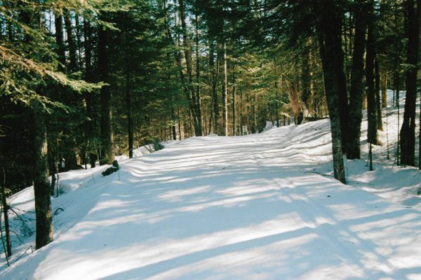
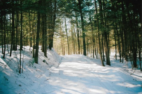
The Alliance has allowed the Club to build and maintain combined ski and snowshoe trails on the Preserve. The Club built a substantial bridge there over Klostermann Creek; the Club maintains and snowplows the Preserve’s parking lot, which is full most winter weekends.

In 2007, a landowner revoked his permission to allow the Ice Age Trail to cross his land. This land was just west of the Preserve and his revocation caused the closure of miles of Trail. The Preserve was now landlocked except for its frontage on Highway C. Bob’s response was to buy two parcels of land and help the Alliance acquire easements on two more so the Trail could reach Rustic Road No. 1.
Bob donated these two parcels and access easements to the Alliance, expanding the Preserve to 47 acres. In 2016, Tim Malzhan, Trailway Director for the Ice Age Trail Alliance, and volunteers of a Mobile Skills Crew event, built Ice Age Trail from County C to Rustic Road No. 1. The especially scenic, well-built portion of the Ice Age Trail’s Rib Lake Segment is also the south portion of the Timm’s Hill Trail (THT). This 10-mile hiking and ski trail ends at Timm’s Hill, Wisconsin’s highest natural point (1,951.5 feet).

Ten years after the landowner severed the Ice Age Trail, it is still not reconnected, however, Trail planners have chosen a spectacular, projected new Trail route. It will move the Ice Age Trail off Rustic Road No.1 and go south and west of the Preserve to reconnect with a section of the Ice Age Trail at the Rib Lake School Forest. It will require two miles of new Trail to be built.
Bob, and his wife, Ann, are in enthusiast support. In 2009, they signed easements for it. In 2019, they decided to do more: they gave the Alliance the land parcels they owned, through which a new portion of Ice Age Trail will run. This gift, involving three 40-acre parcels appraised at $161,500, grew the Preserve to 170 acres.
What prompted Bob & Ann Rusch to donate land?
“After studying all of the options, Ann and I are convinced no other organization has a better history of land protection and stewardship than the Ice Age Trail Alliance,” said Bob.
Here are short descriptions of the three parcels donated in 2019:
Filas Farm 40
The Filas Farm 40 gets its name from a Polish emigrant who bought it in 1920; he lived there with his family and three cows; they all worked hard to clear some of the land and create tillable fields for their small dairy farm.
The farm was abandoned about 1960. Ann acquired the land and, with Bob, planted the fields to pines in 1994. This plantation thrives and provides a carpet of fallen pine needles for the Ice Age Trail. Interpretive signs explain the land’s history to hikers.

Tote Road 40
The Tote Road 40 is just west of the Filas Farm parcel. It is well forested, including a rare, two-acre stand of second growth hemlock through which the ski trail passes; when completed, the Ice Age Trail will run along the hemlocks. White pine are plentiful and will, over time, create an impressive grove through which the Trail will pass.
On September 18, 1881, the founder of Rib Lake, J.J. Kennedy, bought this land, his first purchase made in the area. He wanted its white pine and built a rudimentary “tote” road over hills and around swamps to haul supplies to his “pine camps.”
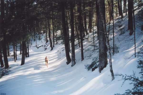
At Tote Road Hill the Ice Age Trail crosses this old tote road, which can still be seen descending the long, steep hill there. The tote wagons were heavily loaded with supplies, pulled by two horses, and had one crude hand brake. The teamster would stop his wagon at the top of Tote Road Hill, get off the wagon, and chain its rear wheels to keep them from turning. Then he would climb back on his seat and urge his team to go down the hill. The rear wheels of the wagon would skid all the way down. Once safely at the bottom of the hill, the teamster would remove the wheel chains and resume his journey.
The Rib Lake Historical Society LLC, of which Bob is the founder and manager, has an online collection of over 10,000 historical documents and photos. This collection includes turn-of-the-century photos of the tote road, wagons, teamsters and horses. These will be used to illustrate an historical marker atop Tote Road Hill.

Terminal Moraine 40
The Terminal Moraine 40 is one-half mile south of the other parcels. There Tim Malzhan, Trailway Director, and Kevin Thusius, Land Conservation Director, have chosen a route for the future Ice Age Trail, including a trail bifurcation, where the Trail will split into two. One leg will run on top of the 25-foot high ridge, part of the terminal moraine. The other leg of the Trail will run along the bottom of this moraine.
Dr. David Mickelson, retired professor of glacial geology at UW-Madison, was the first to confirm that the high ridge of land through this 40-acre parcel was left by the Wisconsin Glacier. It stopped its movement and melted there 12,000-18,000 years ago.
The stagnant melting glacier prevented the deposition of earth, sand, gravel, stones or other material where the glacier sat. For that reason that location is now a low wetland just north of the moraine. It is forested by rare, old-growth white cedar.

The Rusch Preserve is now 170 acres of beautifully forested land featuring several historic sites, including the still visible location of Rib Lake Lumber Co. Camp 6 (1911-1914). The Rusch Preserve’s geological formations are truly impressive. This popular trailhead has picnic tables, a well for fresh water, and four primitive campsites, one reserved for thru-hikers.
Two kiosks display large, detailed, to-scale maps made by land surveyor George Sandul, as well as brochures, historical photos and trail journals. The “five trails” at the Rusch Preserve are the Ice Age, Timm’s Hill, Camp 6 and two ski and snowshoe trails, the 20-mile long Nordic and the 2-mile Beginner Ski Loop.
Thank you, Bob & Ann Rusch, for your dedication to creating, supporting and protecting the Ice Age National Scenic Trail!

